Bünde
Jump to navigation
Jump to search
town in the Herford district, in North Rhine-Westphalia, Germany | |||||
| Upload media | |||||
| Pronunciation audio | |||||
|---|---|---|---|---|---|
| Instance of |
| ||||
| Location | Herford, Detmold Government Region, North Rhine-Westphalia, Germany | ||||
| Located in or next to body of water | |||||
| Head of government |
| ||||
| Population |
| ||||
| Area |
| ||||
| Elevation above sea level |
| ||||
| Different from | |||||
| official website | |||||
 | |||||
Symbols
[edit]-
Coat of arms
-
city flag
-
city banner
Maps/statistics
[edit]-
The parts of the town
-
Geothermical Map of Bünde
-
A map about land use
-
A map about the physical conditions of the landscape in Bünde
-
A climate chart of Bünde
-
Location of Bünde within the district of Herford
-
Locatin of Bünde within the old administrative district of Minden (existing from 1817 until 1831)
-
Statistic of the demographic survey
Historical pictures
[edit]-
The train station in 1903
-
The train station in 1904
Buildings and downtown
[edit]-
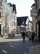
In Downtown Bünde
-
The Tabakspeicher
-
Deutsches Tabak- und Zigarrenmuseum
-
The "Dammhaus", one of the oldest building in town (1595), part of the museum complex
-
The "Hurlbrinksches Haus", part of the museum complex
-
Restaurant "Zur Klinke" situated in a classical half-timbered house seen from the eastern side
-
The restaurant "Zur Klinke" seen from the western side
-
Wellensiekdenkmal
-
The Shoppingstreet "Eschstrasse"
-
Historical buildings at "Museumsplatz"
-
Haus Dahlkötter, the register office
-
One of the Highrises in Bünde-Spradow
-
Highrise apartment complex
-
Villa at Wellensieksquare
-
Villa of Arnold Andre (cigarmanufacturer)
-
A Villa in Eschstrasse
-
Another picture the Villa in Eschstraße
-
A Villa in Hindenburgstreet
-
The memorial remembering the dead soldiers of both world wars, situated in Ennigloh
-
Detail of the "Amtshaus Ennigloh"
-
The "Amtshaus Ennigloh", today including the music school of Bünde
-
The "Amtshaus Ennigloh"
-
The "Amtshaus Ennigloh"
-
The "Amtshaus Ennigloh"
-
A former farmhouse in Ennigloh
-
The "Universum", a former cinema, nowadays an event centre
-
The "Universum", a former cinema, nowadays an event centre
-
The statue of Germania in front of the church St.Laurentius
-
The "Rahningsche Hof", nowadays a restaurant
-
The torso of windmill "Böker"
Places of worship
[edit]-
The church "St. Laurentius"
-
The church "St. Laurentius"
-
The church "St. Laurentius"
-
The church "St. Laurentius"
-
St.Paulus
-
St.Paulus
-
St.Paulus
-
Inside the Church at Bünde-Dünne
-
The Mosque at Ennigloh
-
The memorial at the place of the former synagogue
Traffic
[edit]-
Tabakspeicher and central bus station (ZOB)
-
The train station
-
The train station
-
At the train station
-
A "Regionalexpress" at Bünde station
-
The old depots at the train station (with the former restaurant on this picture)
-
The old depots at the train station (with the actual restaurant on this picture)
-
Panorama of the train station
-
At the train station
-
Rails in Bünde
-
The railway control centre
-
The end of the former rail one
-
The bicycle parking garage near the train station
-
The bicycle parking garage near the train station
Public utility
[edit]-
The Firestation Bünde-Mitte
-
City - Hall
-
City - Hall
-
City - Hall
-
City - Hall
-
The custom office
-
Hospital "Lukaskrankenhaus"
-
The public library
-
The health centre in Ennigloh
Leisure
[edit]-
The indoor swimming pool "Bünder Welle"
-
The entrance of "Bünder Welle"
Festivals
[edit]-
The "Night of the Stars" in 2009
-
A musical show at the "Night of the Stars" 2009
-
An entrance gate to the Christmas market "Laurentiusmarkt"
Economy
[edit]-
Miele Factory Bünde
-
The formerly Porcelain - Factory Severin in Bünde
-
The branch bank "Sparkasse" in Ennigloh
Education
[edit]-
The Erich Gutenberg Berufskolleg (Vocational School)
-
The "Gymnasium am Markt" (Grammar School)
-
The "Freiherr vom Stein Gymnasium" (Grammar School)
-
The "Realschule Bünde - Nord" (Secondary School)
-
The "Siegfried Moning Halle", the gym of the "Freiherr vom Stein Gymnasium"
Nature
[edit]Doberg
[edit]-
Unterkieferstück eines Squalodon sp, gefunden am Doberg, Museum für Naturkunde (Berlin).
-
A sign near the footway to Doberg
Landscape
[edit]-
Afterglow above Bünde
-
River Else in downtown Bünde
-
River Else in winter
-
River Neue Else
-
Typical landscape of Ravensberg in Bünde


